Availability, rates and reservations by phone
0742 095 9050748 373 371

Cabana 84 · Băile Figa · Beclean

From Beclean, towards Colibița.

An out-and-back ride through Bistrița and Prundu Bârgăului to Colibița. References, stops and practical information for planning a motorcycle day.

See the route map
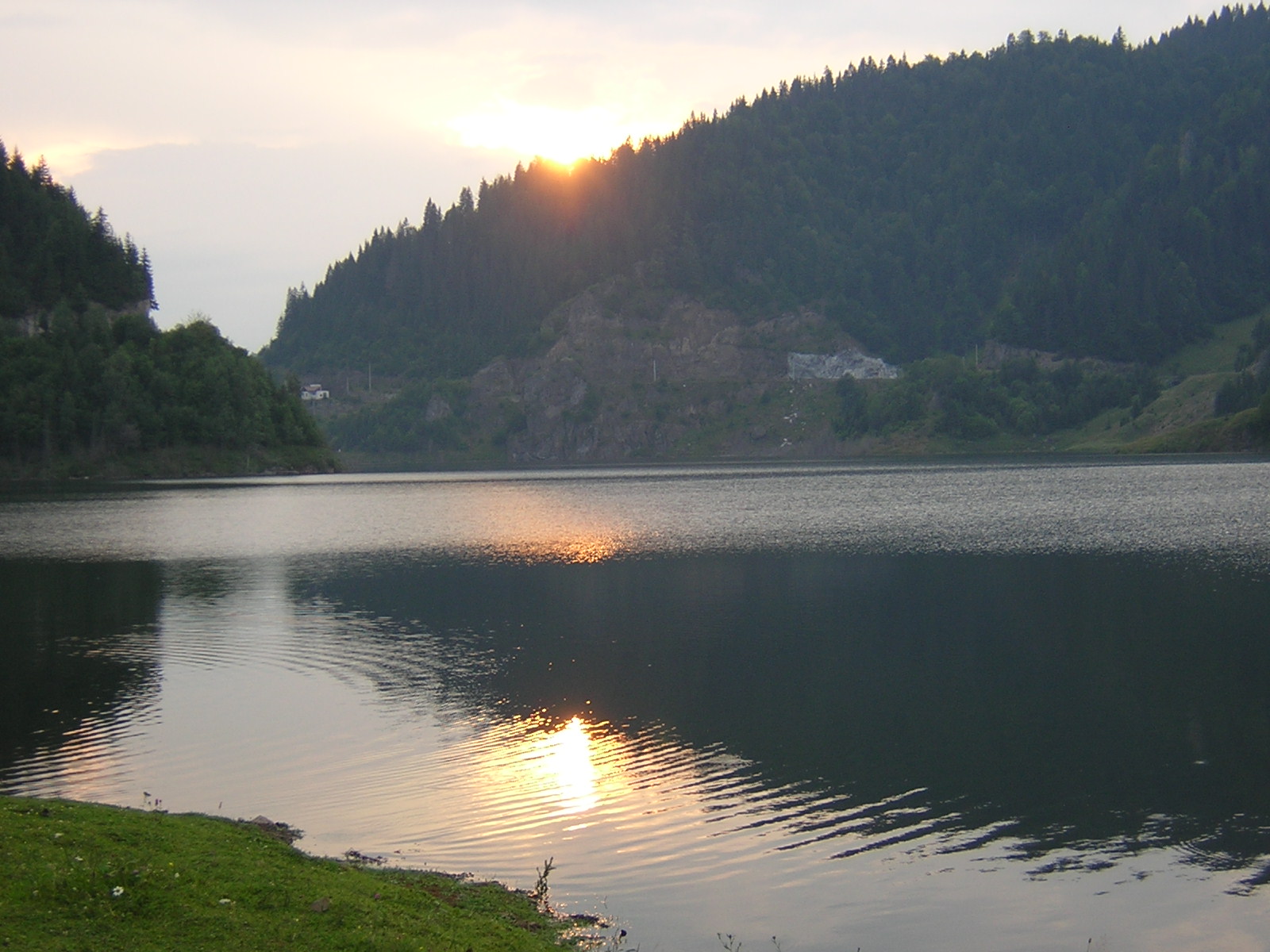
Lake Colibița and its dam in an archival photograph
Lake Colibița · Danretegan / Wikimedia Commons · public domain · archive, uploaded in 2007.
Calculated distance141.3 km
Estimated car time2 h 56 min
FormatOut and back
Online research
Download GPX

Distance and duration are calculated by OSRM using its car profile and OpenStreetMap data, without stops or live traffic. This is a planning GPX, not a recorded ride. Stop detours and the connection to Cabana 84 are excluded.

A local ride from Beclean, separate from the three regional itineraries. This is a calculated plan, not a ride completed by Cabana 84.

Your route, on the map.

Beclean → Bistrița → Prundu Bârgăului → Colibița → Prundu Bârgăului → Bistrița → Beclean

BecleanColibița
Road sketch. Activating loads the OpenStreetMap map.

GPX to plan your journey

The GPX and map share the same calculated geometry. Import the file into your navigator and check restrictions, signs and access. Google Maps may calculate a different road; use stage links for the loop. Download GPX ↗

The route, step by step.

The stages add up to the calculated route. Times are car-model estimates without breaks, not measured motorcycle riding times.

  1. 01

    Beclean → Bistrița

    From the Beclean reference to Piața Centrală in Bistrița. Follow signs and urban access restrictions.

    Navigate this stage ↗
    31.2 km37 min · estimated
  2. 02

    Bistrița → Prundu Bârgăului

    Continue towards the Bârgău valley. Prepare a fuel stop in Bistrița before heading towards the lake.

    Navigate this stage ↗
    23.9 km27 min · estimated
  3. 03

    Prundu Bârgăului → Colibița

    Approach Colibița through the DJ173A area. The endpoint is a road reference, not verified parking or a viewpoint.

    Navigate this stage ↗
    15.8 km24 min · estimated
  4. 04

    Colibița → Beclean

    Return through the same references. One-way streets may make the return geometry differ from the outward route.

    Navigate this stage ↗
    70.3 km87 min · estimated

Fuel. A break. Lunch.

Documented stops, not tested by Cabana 84. Check opening hours and access; detours are excluded from the distance.

Fuel stops

In Bistrița, OMV’s official list gives Str. Libertății 54 and Calea Moldovei f.n. Rompetrol lists a Dej–Bistriței station. Check the station suitable for your route and opening hours in the operator’s locator; do not assume fuel at every mountain waypoint.
A place for lunch · Fisherman’s — Colibița

Fisherman’s advertises a restaurant at Colibița 229B, phone 0371 787 980. Confirm hours, access for non-resident visitors and parking; free lakeshore access is not promised.

Fisherman’s — Colibița ↗

Coffee and a break

You can combine coffee with the restaurant stop after confirming service. These venues have not been tested by us. Choose legal parking away from the carriageway.

Roads and seasons

Surface and difficulty

Road references in the calculation: DN17, DN17VO, DJ151, DJ173C, DJ173A.

The calculation may use side streets and shortcuts. We have no recent inspection of asphalt, gravel or roadworks and do not assign a verified difficulty rating.

INFOTRAFIC ↗

Sections to prepare for

Check the DJ173A approach to Colibița, junctions and access in town centres. We have no recent roadworks or gravel observations.

Seasonal conditions

Check the Beclean and Colibița forecast on your departure day. Rain, fog, low temperatures and ice can change the plan; year-round access is not promised.

ANM ↗

Parking and viewpoints

Map points are route references, not viewpoints or parking with verified access. Confirm parking at your chosen stop and avoid stopping on the carriageway for photographs.

Alternative route

The shorter option is Beclean–Bistrița–Beclean. The first and final calculation legs can be used for planning; this is not a verified diversion around a closure.

62.1 km · 1 h 13 min · estimated

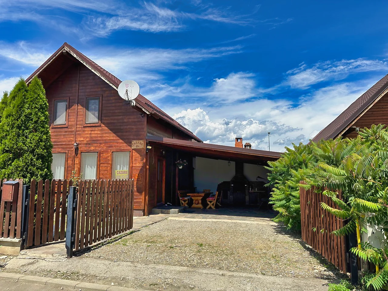
Cabana 84 exterior and courtyard entrance

Cabana 84, along your journey.

The route starts at Piața Libertății in Beclean, not at the cabin gate. Plan the connection from Băile Figa separately using the property pin.

The cabin is in Băile Figa, Aleea 2, Beclean. Use the property pin for the detour from the route. The host confirms private parking; motorcycle capacity, security and covered spaces need a phone discussion. Confirm stay dates directly, including dates outside summer.

Sources and verification.

Online research: . We have no confirmed date when these routes were last ridden or checked by motorcycle, and no own route photographs.

How are distance and time calculated?

Metres and seconds from the saved OSRM response. Car profile, no live traffic. The response does not identify the map data age or validate surface conditions or motorcycle access.

141,273.6 m · 10,532.4 s

Download the calculation data ↗
Reference coordinates

OSRM coordinates snapped to the road network; references, not verified stops.

ReferenceLatitudeLongitude
Beclean47.17975524.179251
Bistrița47.13286324.496658
Prundu Bârgăului47.22015224.740920
Colibița47.17086124.887105
  1. OSRM ↗

    Car calculation method; not field verification.

  2. OpenStreetMap ↗

    Geographic context and road connections; not current road conditions.

  3. OMV — Bistrița ↗

    Operator information; reconfirm hours and access.

  4. Fisherman’s — Colibița ↗

    Operator information; reconfirm hours and access.

  5. INFOTRAFIC ↗

    Check before departure; this page does not show live conditions.

  6. ANM ↗

    Check before departure; this page does not show live conditions.

  7. Danretegan / Wikimedia Commons ↗

    Public-domain archive photograph, not a Cabana 84 ride photograph.